Tuesday, June 23, 2009

Introduction...


Hello everyone... I am Cherry!!! This blog will show you the informations on Mississippi River. Well... it's part of my Geography individual self-pace learning (ISPL). Anyway, this blog is not only for teachers to check on my ISPL, but also for those who pass by this blog. Feel Free to view this blog, where youmwill learn something new on Mississippi River. Mississippi River is a fantastic river. Why? You will find out more later. There are some pictures for you to enjoy. Happy Reading :D

Location of Mississippi River


The Mississippi River of the U.S and of North America, flows south from Lake Itasca, in Northern Minnesota, to the Gulf of Mexico, in Louisiana.

Description of Mississippi River

The Mississippi River is the second-longest river in the United States and it is the fifth largest river in the world by its volume. This river has a length of 2,320 miles, 3,730 km from its source in Lake Itasca in Minnesota to its mouth in the Gulf of Mexico.

The Mississippi River is part of the Missouri-Mississippi river system, which is the largest river system in North America. It is also among the largest in the world with a length of 3,900 miles, 6,300 km. It is the fourth longest, and by its average discharge of 572,000 cu ft/s (16,200 m³/s), it is the tenth largest in North America.


Upper Mississippi River
The upper course of the river is always the source of the river. This is where the river begins. Many smaller streams and channels join up to form larger streams. Several streams join up to form a river. The upper course have deep, narrow, steep-sided, steeper gradient, V-shaped valley.

The upper Mississippi River is divided into three sections:
- The headwaters with a length of 493 miles, 793 km; from the source to Saint Anthony Falls
- A series of man-made lakes between Minneapolis and St. Louis, Missouri with a length of 664 miles , 1,069 km
- The middle Mississippi with a length of 190 miles, 310 km, a relatively free-flowing river downstream of the confluence with the Missouri River at St. Louis.


Source

The source of a river is the place from which the water in the river originates. The source of the Mississippi River is Lake Itasca. It is 1,475 feet, 450 m above sea level in Itasca State Park located in Clearwater County, Minnesota.

The uppermost lock and dam on the Mississippi River is the Upper St. Anthony Falls. Above the dam, the river's elevation is 799 feet (244 m). Below the dam, the river's elevation is 750 feet (230 m). This 49-foot (15 m) drop is the largest of all the Mississippi River locks and dams. By the time the river reaches St. Paul, Minnesota, below Lock and Dam, it has dropped more than half its original elevation and is 687 feet (209 m) above sea level. From St. Paul to St. Louis Missouri the river elevation falls much more slowly and is controlled and managed as a series of pools created by 26 locks and dams. From St. Louis to the Ohio River confluence the Mississippi free falls a total of 220 feet (67 m) over a distance of 180 miles (290 km) for an average rate of 1.2 feet per mile (23 cm/km). At the Ohio River confluence the Mississippi is 315 feet (96 m) above sea level.


Lower Mississippi River
Meanders are common at the lower course of the river. There are many distributaries at this course. River flows towards its mouth and enters the sea. Delta is form at the river mouth. The lower course has shallow-channeled, flat-floored, very gentle to almost flat gradient and very wide almost U-shaped valley.
Major sub-tributaries include the Tennessee River and the Platte River. The Arkansas River joins the Mississippi in southeastern Arkansas. The Yazoo River meets the Mississippi at Vicksburg. The Atchafalaya River in Louisiana is major distributaries of the Mississippi.


Mouth
The mouth of a river is where it meets the ocean. At the mouth of the Mississippi river, it discharges at an annual average rate of between 200,000 and 700,000 cubic feet per second and releases about 400 million yards of mud, sand, and gravel per year.
Although it is the fifth-largest river in the world by volume, this flow is a mere fraction of the output of the Amazon, which moves nearly 7 million cubic feet per second during wet seasons. On average the Mississippi has only one-eleventh the flow of the Amazon River, but is nearly twice that of the Columbia River and almost six times the volume of the Colorado River.

Social and Political background of Mississippi River

Myths and legends

The Delta
The Delta is overpowering Protestant, with considerable diversity among congregations and sects. Episcopal, Baptist, Methodist, and Presbyterian Churches are commonly represented in Delta towns, but so are various evangelical beliefs, ranging from Primitive Baptist through Church of the End Times.


The older churches in the Black community include the Missionary Baptists (MB) and African Methodist Episcopalians (AME) who trace their origin back to 1788 when they were founded by Freedmen. The Delta also played an important role in the origin of a derivative of the black Baptist church. Charles Harrison Mason, after meetings on courthouse steps in Jackson and in private homes, established the Church of God in Christ in a gin house in Lexington, Mississippi, Holmes County, in 1897. A small but permanent church was built later that year. Mason had originally been ordained a Missionary Baptist.


The Delta has a rich religious heritage, and is a land where faith- in God, in the future, in grace, and in ultimate redemption - unify all people.


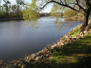
Little Zion Missionary Baptist Church


A typical backroads Mississippi church
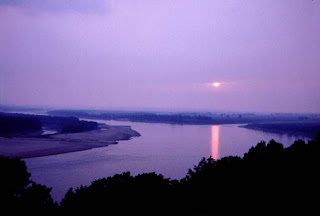


The Pepie
Derives from the numerous sightings of an unexplained creature or creatures surfacing from the depths of Lake Pepin in the Mississippi River. These sightings have taken place from both ship and shore. To date, none of these sightings have confirmed the existence of a new biological species.


Like most legends, Pepie is also a mythological creature. The myths are even more colorful and fantastic than the legend! Local mythology claims that Pepie is a shy, gentle, and playful creature. He especially loves to play on the surface of Lake Pepin when the waters are very, very calm and reflect the skyline of the beautiful forested bluffs that surround the Lake. When a full moon rises over the Lake, it is transformed into a magical playground that no aquatic creature can resist!Lake Pepin is also the home to many fresh water mussels, more commonly called "clams". These clams were once the source of a major industry on the upper Mississippi River, "Mother of Pearl" clothing buttons. Local mythology claims that one huge clam was the "Mother of all Lake Pepin Clams".Not only did all of the other clams descend from her, she also makes the largest pearls seen anywhere in the world! She is commonly referred to as "Clara the Clam". Clara is a friend of Pepies.


Clara and Pepie love to engage in her favorite water sport on those magical moonlit nights that occur on Lake Pepin. Since Pepie is a very, very fast swimmer, Clara ties a rope to him, straps on some water-skis and has Pepie pull her around the Lake as she skims across the surface of Lake Pepin on her water-skis. We are not saying that you will always catch a glimpse of Pepie or Clara when you visit Lake Pepin, but we do guarantee that you will always enjoy breathtaking scenery and sights that you will cherish forever!


The pepie


Great Mississippi Flood of 1927
The Great Mississippi Flood of 1927 was the most destructive river flood in the history of the United States.


The flood began when there is heavy rain at the central basin of the Mississippi in the summer of 1926. By September, the Mississippi's tributaries in Kansas and Iowa were swollen to capacity. On New Year's Day of 1927, the Cumberland River at Nashville topped levees at 56.2 feet (17 m).


The Mississippi River broke out of its levee system in 145 places and flooded 27,000 square miles (70,000 km2). The area was inundated up to a depth of 30 feet (10 m). The flood caused over $400 million in damages and killed 246 people in seven states.


The flood affected Arkansas, Illinois, Kentucky, Louisiana, Mississippi, Missouri, Tennessee, Texas, Oklahoma, and Kansas. Arkansas was hardest hit, with 14% of its territory covered by floodwaters. By May 1927, the Mississippi River below Memphis, Tennessee, reached a width of 60 miles (97 km).


Great Flood of 1993
The Great Flood of 1993 was among the most costly and devastating ever to occur in the United States, with $15 billion in damages. The hydrographic basin affected covered around 745 miles (1200 km) in length and 435 miles (700 km) in width, totaling about 320,000 square miles (840,000 km²). Within this zone, the flooded area totaled around 30,000 square miles (80,000 km²) and was the worst such U.S. disaster since the Great Mississippi Flood of 1927, as measured by duration, square miles inundated, persons displaced, crop and property damage, and number of record river levels. In some categories, the 1993 flood even surpassed the 1927 flood, at the time the largest flood ever recorded on the Mississippi.


The 2001 Flood at Upper Mississippi River
For many communities along the upper Mississippi River, the 2001 flood brought the second highest water levels on record. The 2001 flood crest exceeded the crests from the 1993 and 1997 flood at most locations. Only the 1965 flood was worse.


Over the winter of 2000 - 2001, there was heavy snow in southern Wisconsin, northern Iowa, and southern Minnesota. A late, rapid snowmelt combined with heavy rain, led to the flood. There were actually two flood crests in 2001 at many locations. The first occurred around April 20 to 25. Additional rain led to a second crest the week of April 29.


The early spring flood forecasts indicated only minor flooding along the Mississippi. In early April, it became apparent that rapidly warming temperatures and rain would lead to significant flooding. The National Weather Service issued new forecasts calling for near record flooding in many locations, and the sandbagging began.


Flooding also occurred along the Minnesota and St. Croix rivers, both of which flow into the Mississippi. Flooding also occurred along the Red River, which flows north into Canada from Minnesota and North Dakota.


At this time, May 22, the river has finally dropped below flood stage, after over a month above flood stage. Now, the cleanup can begin, and the extent of damage can be determined. There is damage, but it could have been much worse. Several communities built floodwalls or dikes after the 1965 flood, which protected those communities from major damage this time.


Lake Pepin monster- The pepie

Mississippi River Flood 1993 Case Study

Mississippi River Flood 1927

Uses of Mississippi River


Recreation


Water skiing
The sport of water skiing was invented on the river in a wide region between Minnesota and Wisconsin known as Lake Pepin. Ralph Samuelson of Lake City, Minnesota, created and refined his skiing technique in late June and early July 1922. He later performed the first water ski jump in 1925 and was pulled along at 80 miles per hour (128 km/h) by a Curtiss flying boat later that year.


Water supply
Communities up and down the river use the Mississippi to obtain fresh water and to discharge their industrial and municipal waste. We don't have good figures on water use for the whole Mississippi River Basin, but we have some clues. A January, 2000 study published by the Upper Mississippi River Conservation Committee states that close to15 million people rely on the Mississippi River or its tributaries in just the upper half of the basin (from Cairo, Il. to Minneapolis, MN). A frequently cited figure of 18 million people using the Mississippi River Watershed for water supply comes from a 1982 study by the Upper Mississippi River Basin Committee. The Environmental Protection Agency simply says that more than 50 cities rely on the Mississippi for daily water supply.


Commerce
For nearly 200 years agriculture has been the primary user of the basin lands, continually altering the hydrologic cycle and energy budget of the region. The value of the agricultural products and the huge agribusiness industry that has developed in the basin produces 92% of the nation's agricultural exports, 78% of the world's exports in feed grains and soybeans, and most of the livestock and hogs produced nationally. Sixty percent of all grain exported from the US is shipped via the Mississippi River through the Port of New Orleans and the Port of South Louisiana. In measure of tonnage, the largest port in the world is located on the Mississippi River at Laplace, La. Between the two of them, the Ports of New Orleans and South Louisiana shipped more than 243 millions tons of goods in 1999. Shipping at the lower end of the Mississippi is focused on petroleum, iron and steel, grain, rubber, paper and wood, coffee, coal, chemicals, and edible oils.


River traffic
To move goods up and down the Mississippi, the U.S. Army Corps of Engineers maintains a 9-foot shipping channel from Baton Rouge, La. to Minneapolis, MN. From Baton Rouge past New Orleans to Head of Passes, a 45 foot channel is maintained to allow ocean-going vessels access to ports as far upstream as Baton Rouge.


Wildlife
The Mississippi River and its floodplain are home to a diverse population of living things:


- At least 260 species of fishes, 25% of all fish species in North America
- Forty percent of the nation's migratory waterfowl use the river corridor during their Spring and Fall migration
- Sixty percent of all North American birds (326 species) use the Mississippi River Basin as their migratory flyway
- From Cairo, IL, upstream to Lake Itasca, there are 38 documented species of mussel. On the Lower Mississippi, there may be as many as 60 separate species of mussels
- The Upper Mississippi is host to more than 50 species of mammals;
- At least 145 species of amphibians and reptiles inhabit the Upper Mississippi River environs.


Towboat statistics
- On one gallon of fuel, 1 ton of cargo can be moved 60 miles by truck, 202 miles by rail, and 514 miles by barge.
- One barge holds as much as 15 jumbo rail hoppers and 58 semi truck trailers.
- One barge load of wheat is enough to bake 2.25 million loaves of bread.


Physical features along Mississippi River

Tributaries
The Mississippi is joined by the Minnesota River south of the Twin Cities, the St. Croix River near Prescott, Wisconsin, the Wisconsin River in Prairie du Chien, Wisconsin, the Rock River in the Quad Cities, the Iowa River near Wapello, Iowa, the Skunk River south of Burlington, Iowa, the Des Moines River in Keokuk, Iowa, the Illinois River and the Missouri River near St. Louis, and by the Ohio River at Cairo, Illinois.


Waterfall

Formation


1) By flowing across zones of rock with different resistance to erosion
§ River flows across near vertical bands of rocks of different degrees of resistance to erosion
§ Less resistance rocks erode faster resulting in abrupt steepness in gradient
§ Waterfall forms where there is sudden fall in height
§ River plunges and hits the bottom of the river bed with great force
§ Rocks swirl around base forming deep pool known as plunge pool

2) By faulting
§ Rocks are uplifted
§ Displacement of rocks results
§ One layer of rocks higher than the other
§ Gradient of the river bed changes abruptly

River Warren Falls

It was North America’s greatest waterfall. River Warren Falls formed in what is now downtown Saint Paul, Minnesota, at the end of the last Ice Age. The power of the cascading waters continually eroded the base of River Warren Falls and over the next several thousand years the waterfall moved 15 miles up the Mississippi River creating a deep gorge. It ended up in downtown Minneapolis as Saint Anthony Falls—the “Waterfall that Built a City.” In its wake, a rock-walled gorge was carved. Streams became waterfalls as they leapt into the chasm, and none more famous than the Minnehaha Falls celebrated in the epic poem, The Song of Hiawatha, by Henry Wadsworth Longfellow.

The only waterfalls along the entire 2,300-mile length of the Mississippi River. It is a thoroughly researched book that chronicles the early explorations of the Upper Mississippi River, leads you to tropical marine corals captured in stone, reminisces on the visits of Henry David Thoreau, Mark Twain, and Dvorak, and tells the tale of a 200-pound rodent dropped dead in the prime of its life.


Meanders


Characteristics
- Twists and turns or hoop-like bends in river
- Most prominent in middle and lower courses but can occur anywhere along course
- No depositional landform formed on concave bank because water too swift with little or no load.


Formation


§ Upper Course:
- Gradient steep but meanders occur when river volume and energy low; due to obstacles e.g. resistant rock outcrops, hence twist and turn to avoid obstacles to find easiest route.


§ Middle Course:
- gradient gentler
- flow velocity and energy decrease
- insufficient energy for vertical erosion despite greater volume as gentler gradient means weaker gravitational pull
- Lateral erosion dominant
- Lateral cutting or erosion causes meanders to form
- Speed of flow faster and stronger on concave bank causing erosion by undercutting
- Speed of flow slower on concave bank causing deposition


§ Most common in lower course of river
§ As erosion and deposition continue on concave and convex banks respectively, meander becomes more pronounced and separated by narrow neck

As it winds from Minnesota to the Gulf of Mexico, the Mississippi River is in constant flux. Fast water carries sediment while slow water deposits it. Soft riverbanks are continuously eroded. Floods occasionally spread across the wide, shallow valley that flanks the river, and new channels are left behind when the water recedes.


Levees
Natural embankment formed by coarser alluvium deposited on and along river banks

Formation
- As floodwaters subside, coarser materials get caught on banks and settle on them
- Accumulation of coarser materials on banks raises them higher than floodplain to form levees
- Abundant sediments brought down by rivers may cause river beds to be raised
- River channel will thus flow at an elevation higher than floodplain

The Mississippi River levees are designed to protect the alluvial valley against the project flood by confining flow to the leveed channel, except where it enters the natural blackwater areas or is diverted purposely into the floodway areas.


The main stem levee system, comprised of levees, floodwalls, and various control structures, is 2,203 miles long. Some 1,607 miles lie along the Mississippi River itself and 596 miles lie along the south banks of the Arkansas and Red rivers and in the Atchafalaya Basin.


The levees are constructed by the federal government and are maintained by local interests, except for government assistance as necessary during major floods. Periodic inspections of maintenance are made by personnel from the U.S. Army Corps of Engineers and from local levee and drainage districts as it is essential that the levees be maintained in good condition for their proper functioning in the flood control plan.


Delta
Flat piece of land made up of layers of sediment deposited at river mouth over time.


Characteristics
- Triangular-shaped flat alluvial plain at river mouth marked by numerous disbutaries
- Delta classified according to shape
- Most common shape is triangular
- Composed of fertile alluvial soil vital for agriculture


Formation
- When river enters water body, river velocity and energy decrease causing deposition to occur
- Sand deposited close to shore, while fine slit and clay carried further out to sea before being deposited
- Over time, layers of sediment build up and form extensive platform of sediment at river mouth
- Triangular-shaped depositional feature is delta
- Smaller delta may form in same way when river enters lake


The Mississippi River Delta is the modern area of land built up by alluvium deposited by the Mississippi River as it slows down and enters the Gulf of Mexico. The deltaic process has, over the past 5,000 years, caused the coastline of south Louisiana to advance gulfward from 15 to 50 miles (24 to 80 km).


It is a biologically significant region, comprising 3 million acres (12,000 km²) of coastal wetlands and 40% of the salt marsh in the contiguous United States. It is also a commercially significant region, supporting the economy of New Orleans with significant shipping traffic, providing 16 to 18 % of the US oil supply, and providing 16 % of the US's fisheries harvest, including shrimp, crabs, and crayfish.


The Mississippi River Delta is not to be confused with the Mississippi Delta region, an alluvial plain located some 300 miles northward in western Mississippi along the River.


Oxbow lake
Truncated section of meander in river channel which form ‘c’ shape


Formation
- Erosion takes place on concave bank and deposition on convex bank of meander
- As erosion and deposition continue on concave and convex banks respectively, meander becomes more pronounced and separated by narrow neck
- Overtime, river breaks through narrow neck and flows through straight channel. Deposition begins to cut meander off from river
- Eventually, meander completely cut off and oxbow lake forms


The Reelfoot Lake in west Tennessee is an oxbow lake formed when the Mississippi River changed course following the New Madrid Earthquake of 1811–1812. There are many oxbow lakes alongside the Mississippi River and its tributaries. The largest oxbow lake in North America, Lake Chicot, was originally part of the Mississippi River.